Our Projects

Environmental Monitoring
Geospatial imaging backed by on-the-ground analysis is transforming the monitoring of heritage and the environment
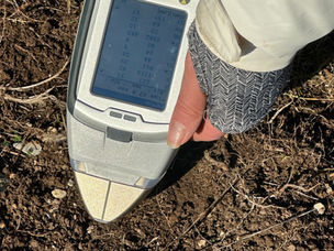
LSN has been involved in pioneering work supported by the UK's Humanitarian Innovation Fund to explore the opportunities with open source earth observation data, drone surveys and community to map, model and monitor sensitive sites around the world.
Working with communities we have been training local teams to document sentinel sites from the deserts of Mali to the coast of Zanzibar in 3D, enabling local people to explore these structures in the fourth dimension – through time and also through different spectra – to reveal the unseen. We have been exploring innovative ways of helping people analyse, experience, and understand such places in new ways either on-line, in VR, AR or mixed reality.


